Ride To South Dakota’s Parks And Monuments
If you want to mellow out between parties and concerts during the Sturgis rally, you may have to get a little distance between yourself and Party Central for a few hours. You can take a nap, maybe sleep off a hangover, or you can head out the parks and monuments South Dakota has to offer year-round.
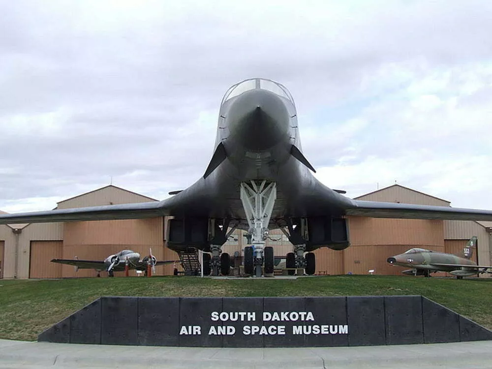
The South Dakota Air and Space Museum. If it’s this cool outside, imagine what’s in it.
Courtesy of Sturgis Motorcycle Rally
South Dakota Air and Space Museum
Distance: 37.1 miles
235 Main Gate Road, Box Elder, SD 57719
The South Dakota Air and Space Museum, part of the museum system of the National Museum of the US Air Force, is located in Box Elder, South Dakota, just outside the main gate of Ellsworth AFB. The South Dakota Air and Space Museum serves to educate and entertain the public. Not only does it give information about the history of US Air Force aviation, but it promotes South Dakota aviation history. There are 30 aircraft ranging from World War II bomber and transport aircraft to the contemporary B-1B Lancer.
Mount Rushmore
Distance: 52.1 miles
Coordinates: 43°52’44.21″N 103°27’35.37″W
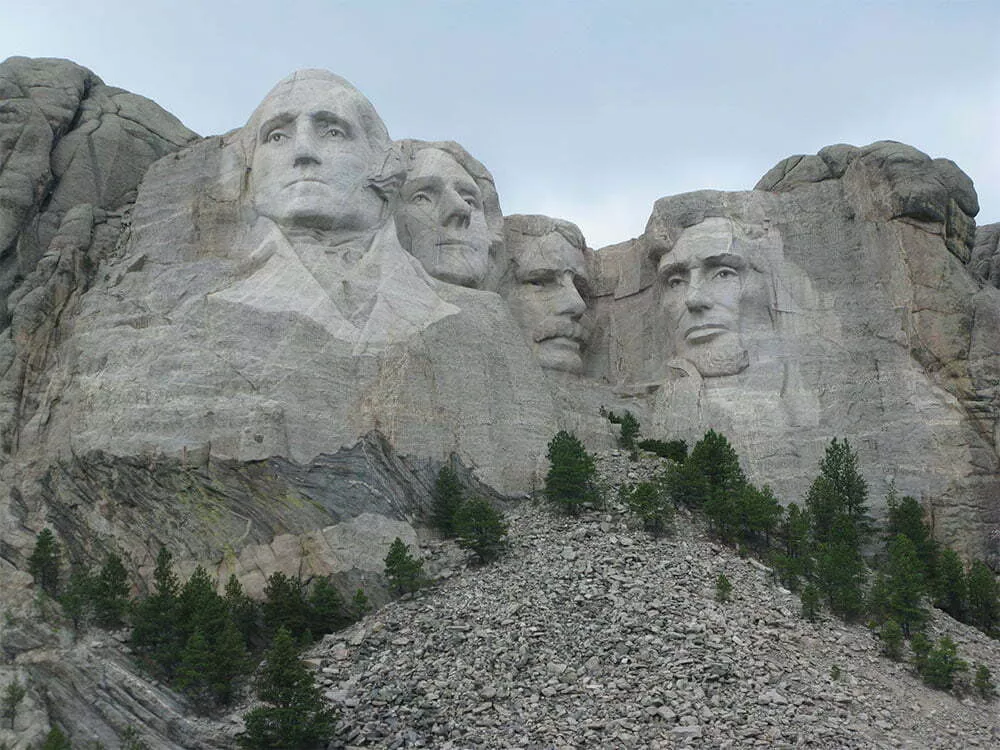
Mount Rushmore in all of its granite glory.
Courtesy of Sturgis Motorcycle Rally
South Dakota’s most famous rock monument would be Mount Rushmore. Carved into the likenesses of presidents Teddy Roosevelt, Thomas Jefferson, Abraham Lincoln, and George Washington, it’s one of those must-see stops for anyone at the rally. Located 52 miles from Sturgis proper off of Highway 244, it’s a good excuse to hop on your scoot and head out of the hustle and bustle of Main Street.
South Dakota historian Doane Robinson is credited with conceiving the idea of carving the likenesses of famous people into the Black Hills region of South Dakota in order to promote tourism in the region. Robinson’s initial idea was to sculpt the Needles (part of Canyonlands National Park, Utah); however, Gutzon Borglum rejected the Needles site because of the poor quality of the granite and strong opposition from Native American groups. They settled on the Mount Rushmore location, which also has the advantage of facing southeast for maximum sun exposure. Robinson wanted it to feature Western heroes like Lewis and Clark, Red Cloud, and Buffalo Bill Cody, but Borglum decided the sculpture should have a more national focus and chose the four presidents whose likenesses would be carved into the mountain.
Custer State Park
Distance: 58.4
Coordinates: 43°44’45″N 103°25’5″W
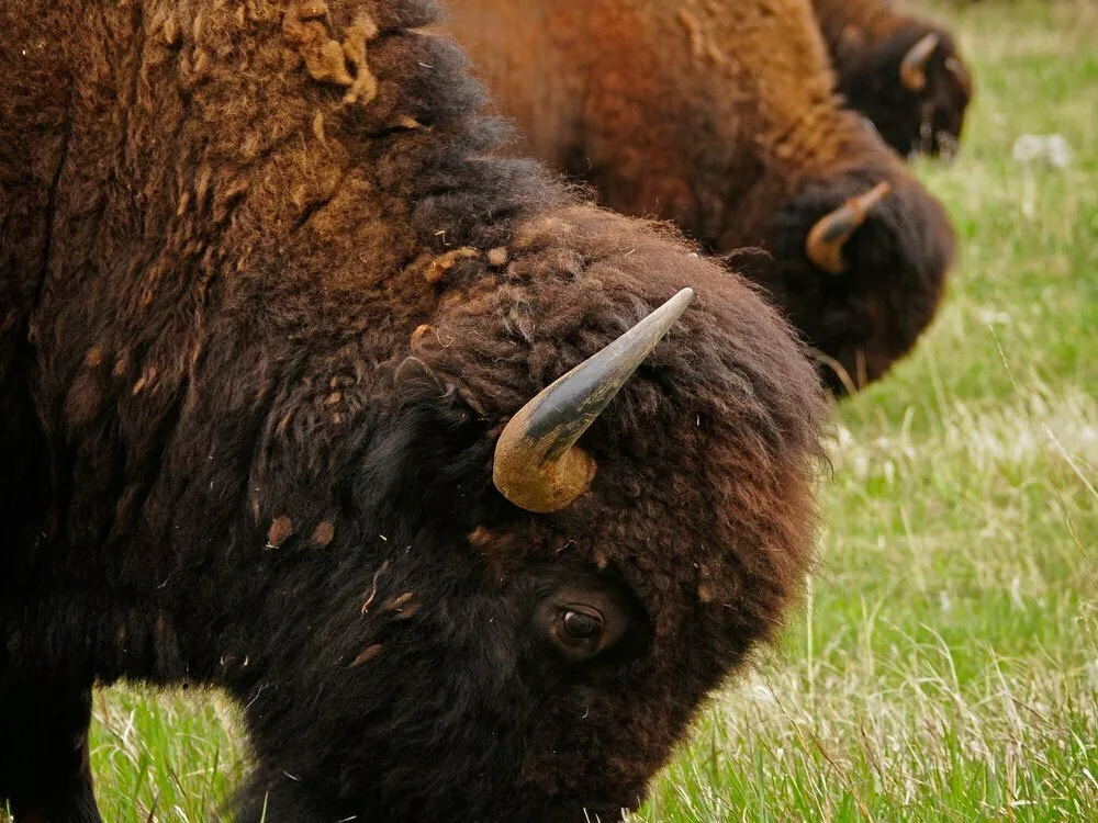
Bison grazing at Custer State Park
Courtesy of Sturgis Motorcycle Rally
Just so we’re clear, this isn’t where the general and 7th Cavalry met their famous demise in 1876. It is, however, named after Custer. Custer State Park is home to a herd of free-ranging bison, which, if you’ve never seen up close and personal, are definitely worth the experience. The park is also known for its Begging Burros, so named because they wander right up to cars begging for food. Each year, some of the bison are auctioned off in September to keep their numbers at a sustainable level. Elk, mule deer, and bighorn sheep also inhabit the park.
Jewel Cave National Park
Distance: 69 miles
Coordinates: 43°43’46″N103°49’46″W
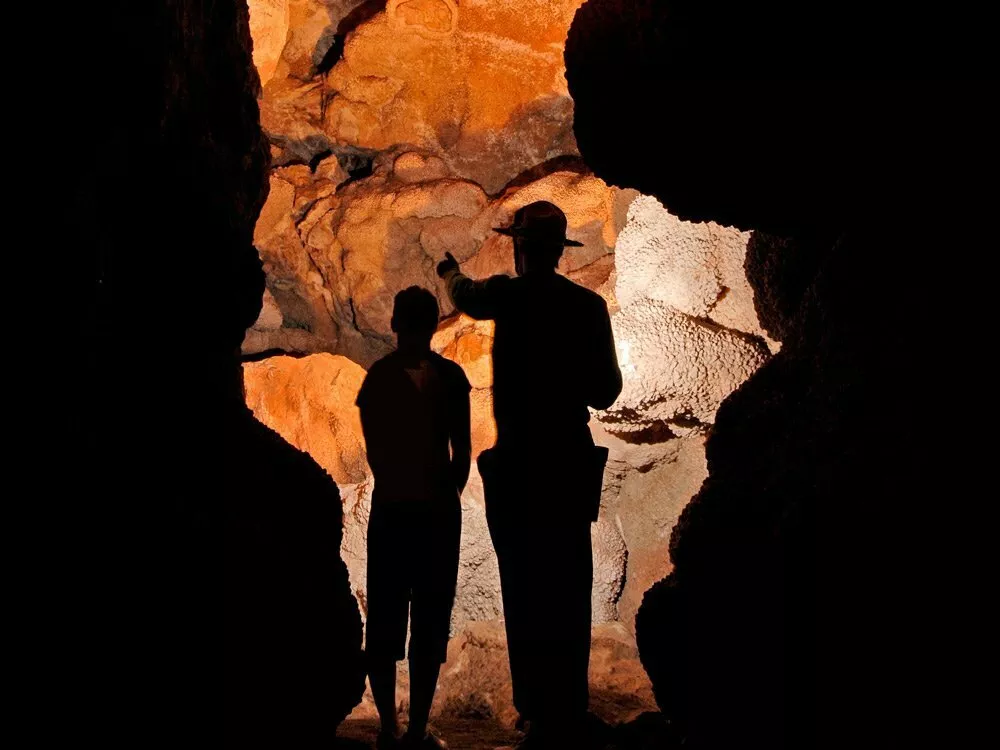
Jewel Cave National Park
Courtesy of Sturgis Motorcycle Rally
Jewel Cave National Park is home to the third-largest cave in the world, second only to the first-largest cave and my old apartment from college. In all seriousness, what makes it truly cool is the 180-plus miles of mapped and surveyed passages, containing brilliant colors and crystalline formations. Its maze of passages lure explorers, and its scientific wealth remains a mystery. This resource is truly a jewel in the National Park Service.
Crazy Horse Memorial
Distance: 66.1 miles
Coordinates: 43°50’12.44″N 103°37’27.79″W
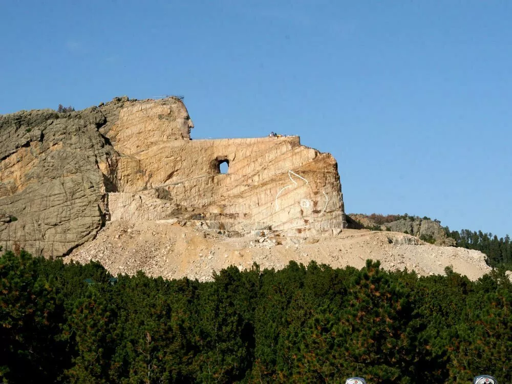
The Crazy Horse Memorial
Courtesy of Sturgis Motorcycle Rally
Way back in 1948, construction started on the Crazy Horse Memorial in Custer County, South Dakota. It’s on privately held land depicting Crazy Horse, an Oglala Lakota war chief, riding a horse and pointing into the distance. It’s operated by the Crazy Horse Memorial Foundation, a private nonprofit organization.
The memorial consists of the mountain carving (monument), the Indian Museum of North America, and the Native American Cultural Center. The monument is being carved out of Thunderhead Mountain on land considered sacred by some Oglala Lakota, between Custer and Hill City, roughly 17 miles from Mount Rushmore. The sculpture’s final dimensions are planned to be 641 feet wide and 563 feet high. The head of Crazy Horse will be 87 feet high; by comparison, the heads of the four US presidents at Mount Rushmore are each 60 feet high.
The monument has been in progress since 1948 and is far from completion. If completed, it may become the world’s largest sculpture, as well as the first non-religious statue to hold this record since 1967 (when it was held by the Soviet monument The Motherland Calls).
Devils Tower
Distance: 81.2 miles
Coordinates: 44°35’26″N 104°42’56″W
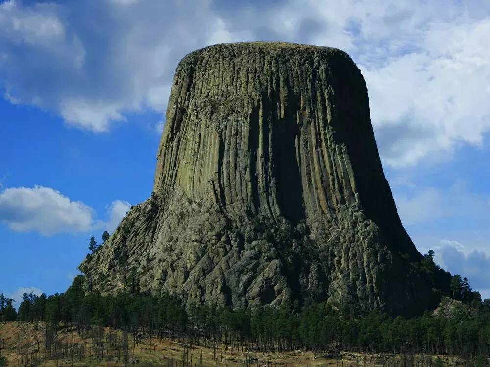
Devil’s Tower. It’s not as mean as it looks.
Courtesy of Sturgis Motorcycle Rally
Devils Tower is an astounding geologic feature that protrudes out of the rolling prairie surrounding the Black Hills. This site is considered sacred to the Lakota and many other tribes that have a connection to the area. Hundreds of parallel cracks make it one of the finest traditional crack climbing areas in North America. Devils Tower entices us to explore and define our place in the natural and cultural world. Anyone covering the Sturgis Motorcycle Rally always takes a photo of Devils Tower.
One of the best times to see the tower is at night though. Two places near it offer great night viewing. Joyner Ridge Parking Lot and Trail: Turn left onto a gravel road just before you reach the Devils Tower Visitor Center and travel until you reach a round parking lot. It provides one of the best views of the tower. The area is ideal for dark-sky photos.
Circle of Sacred Smoke Sculpture and Picnic Area: Turn left and then left again, just before you reach the park administration building and park in the picnic area/amphitheater parking lot. With few trees, the night sky opens up over Devils Tower.
Wind Cave National Park
Distance: 86.9 miles
Coordinates: 43°33’23″N 103°28’43″W
Bison, elk, and other wildlife roam the rolling prairie grasslands and forested hillsides of one of America’s oldest national parks. Below the remnant island of intact prairie sits Wind Cave, one of the longest and most complex caves in the world. Named for barometric winds at its entrance, this maze of passages is home to boxwork, a unique formation rarely found elsewhere.
Minuteman Missile National Historical Site
Distance: 101 miles
Coordinates: 43°55’52″N 102°09’38″W
You may have heard us old folks refer to a little thing called the Cold War. It was a bit of unpleasantness between the United States and USSR that colored the entire second half of the 20th century. Think of it as two guys in a Tarantino film holding guns to each other’s heads in a standoff, only the standoff lasted more than four decades, and the guns were nuclear missile arsenals. South Dakota hosted some of those missiles at places like the Minuteman Missile National Historical Site. If you want to see that history for yourself, you should ride out to it. This National Historic Site consists of three facilities: a main office and two significant Cold War-era sites, a launch control center, and a missile silo/launch facility.


